Rita Now a Cat 4 Hurricane With Claws

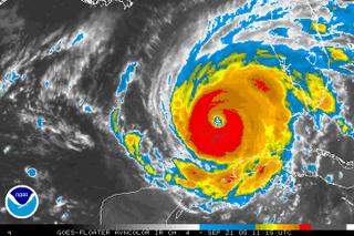
As can be seen from the latest NOAA satellite image, Rita has developed into a well formed hurricane. Presently 140 mile an hour winds are being generated. NOAA predicts there will be more strengthening.
Southern Florida, and northern Cuba, will continue to saturated with more rain as Rita starts to make it move to landfall in Texas.
The east side of Rita could produce dangerous amounts of rain, for New Orleans. And New Orleans already weakened levees may not hold.
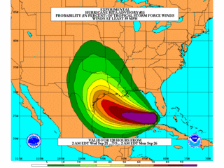
The map you see is an experimental model from NOAA, that projects wind force, and location of Rita's probable location when it makes landfall.
Mandatory evacuations are now ordered for the affected areas.
 Rita is on a path of destruction and its devastation could equal the wrath of Katrinia.


0 Comments:
Post a Comment
<< Home