
The Latest Track of OPHELIA


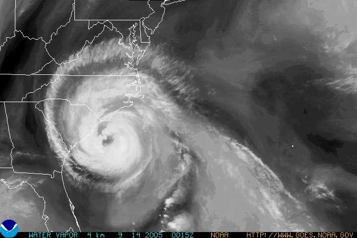
Update 11 pm est, Sept 14th the latest NOAA picture of Ophelia is the top image.
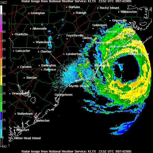
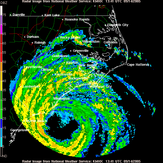
Update: 12 noon Sept 15th Ophilia has made landfall off Cape Hatteras of North Carolinia. Recent warnings are telling the residents to stay put. Winds are sustained at 80 miles per hour with gusts up to 94. Damage reports are just now coming in.
NWS TPC/NATIONAL HURRICANE CENTER MIAMI FL7 AM EDT THU SEP 15 2005 ...OPHELIA NOT IN A HURRY TO MOVE AWAY FROM THE OUTER BANKS... A HURRICANE WARNING REMAINS IN EFFECT FROM SURF CITY TO THE NORTHCAROLINA/VIRGINIA BORDER...INCLUDING THE PAMLICO AND ALBEMARLESOUNDS. A TROPICAL STORM WARNING REMAINS IN EFFECT NORTH OF THE NORTHCAROLINA/VIRGINIA BORDER TO CAPE CHARLES LIGHT VIRGINIA...INCLUDINGTHE CHESAPEAKE BAY SOUTH OF NEW POINT COMFORT. A HURRICANE WARNING MEANS THAT HURRICANE CONDITIONS ARE EXPECTED INTHE WARNING AREA WITHIN THE NEXT 24 HOURS. A TROPICAL STORM WARNINGMEANS THAT TROPICAL STORM CONDITIONS ARE EXPECTED IN THE WARNINGAREA WITHIN THE NEXT 24 HOURS.
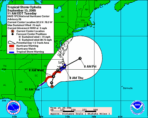
NHC forecast tracks of the center can be in error; the average track forecast errors in recent years was used to construct the areas of uncertainty for the 3 days (solid white area). There is also uncertainty in the NHC intensity forecasts. The intensity forecast chart and table provide intensity forecast and intensity forecast uncertainty information.
This display shows an approximate representation of coastal areas under a hurricane warning (red), hurricane watch (pink), tropical storm warning (blue) and tropical storm watch (yellow). The orange circle indicates the current position of the center of the tropical cyclone. The black line and dots show the National Hurricane Center (NHC) forecast track of the center at the times indicated. The letter inside the dot indicates the NHC's forecast intensity for that time.
From NOAA
posted by B O B @ 1:49 PM
1 comments
![]()
![]()

1 Comments:
Why Ophelia - they should have named it Oprah
Post a Comment
<< Home